Historic Landscape
Characterisation
The Gwent Levels
20 Marshfield/Coedkernew
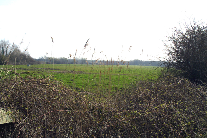
20 Marshfield/Coedkernew character area: low-lying back-fen
landscape north of major "catchwater drain".
(Photo: GGAT Gwent Levels 093)
Click here for a character area map
This landscape is broadly medieval, though Drenewydd/Percoed Reen could be a Roman drainage feature.
This area, known as "Black Moores", is the lowest-lying in all the Level. Discoveries of prehistoric "bog oaks" from the peat, which lies just below the surface, are explained in local tradition as having been washed there during the floods of 1606.
Key historic landscape characteristics
Mixed fieldscape arranged in small blocks of rectangular fields, major
and important catchwater drain (Drenewydd/Percoed Reen), parochial centres
(Marshfield and Coedkernew) and dispersed fen-edge agricultural settlement
This landscape represents the fen-edge and low-lying back-fen area between Marshfield village in the west and Tredegar Park in the east. It is bounded by Drenewydd/Percoed Reen to the south (areas 17 and 21).
Drenewydd/Percoed Reen appears to be a "catchwater drain"; it collects freshwater from the uplands and channels it into Broadway Reen that flows to the coast. It may be Roman in date, having a close parallel to the Lincolnshire Car Dyke in the English Fenland.
The pattern of fields is very mixed, but mainly they are arranged in small blocks of rectangular fields, rather different to the long narrow fields found to the south. The fen-edge is deeply indented with a series of small valleys, which along with several "islands" of bedrock give some areas the impression of being quite enclosed by the uplands. Recent hedge planting, which would be an asset in area 18 and 19, is totally out of place here.
A number of farms occur around the fen-edge, along with Coedkernew and Marshfield churches.
This is a very open landscape, typical of the low-lying back-fens. Hedges are few, affording fine views of the fen-edge/bedrock margins.
The integrity and coherence of this area are considered to be high. There
are relatively few areas of low-lying back-fen surviving where the interface
with the fen-edge is preserved. This is a fine example, with a wide range
of landscape elements; the churches at Marshfield and Coedkernew, and
a series of fen-edge farms overlook it. Drenewydd/Percoed Reen is of great
importance to the drainage of the Levels, and possibly Roman in date.
The area is largely secluded and quiet, with few developments impinging
upon it.